Dzhanaleeva G.M., Ramazanova
N.Y.
Eurasian
National University named after L.N. Gumilyov
HYDROCHEMICAL CONDITION OF BASINS OF THE SMALL
RIVERS OF THE WEST KAZAKHSTAN (FOR EXAMPLE BYKOVKA RIVER BASIN)
In this article is given the analysis of a hydrochemical
condition of a superficial drain of the river Bykovka. Results of the analysis
of laboratory tests of water of the river Bykovka on the key sites of a field season in 2011 are presented.
The transboundary river
Ural and its inflows are the main waterway of Republic Kazakhstan and the
Russian Federation. Now ecological conditions of the Ural river basin and
adjoining territory cause considerable anxiety. Increasing rates of technogenic loading lead to pollution of
waters and deterioration of qualitative structure of reservoirs
On
the territory of the West Kazakhstan area flows 196 rivers from which only 8
have a constant flow. The main waterway is the river Ural which develops of the
rivers flowing down with General Syrt (Embulatovka, Bykovka, Rubezhka, Chagan
with Derkul), the rivers flowing down with the Poduralsky plateau (Ilek, Utva,
Barbastau, Soljanka. Last follows from the lake of Shalkar into which the
rivers Small Ankata and Big Ankata run).
Many scientists in Orenburg and West
Kazakhstan region were engaged by the problems of pollution of surface runoff Ural basin
in different years [1,2,3,4,5,6,7].
The
purpose of our study was the pool,
one of the typical small steppe rivers of the
Ural river - the river Bykovka.
The river is 59.66 km, the catchment basin - 276 km 2, width-10-20
m.
The river Bykovka flows down,
proceeding on territory of intensive economic use, receives polluting
substances from the catchment basin and concerns small waterways in connection
with its local value. There are no bayous and lakes in a flood plain of the river. The
Water level in the river
in the spring and in the autumn considerably
raises at the expense of thawed snow and an atmospheric precipitation. By the end
of summer the river dries up forming separate reaches (fig. 1). 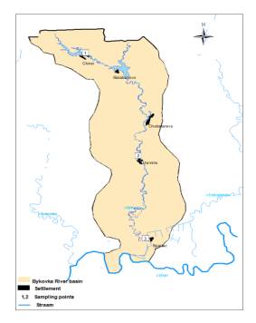
Figure 1. Scheme of the Bykovka river basin
The main
technological factors polluting the river include:
ferrous and nonferrous metallurgy,
chemical industry, human settlements along
the river banks with a low ecological
culture of population, household waste
water polluting agro genesis
factors include: the
industry of agricultural production (livestock,
agriculture, etc.).
Infringements of water balance is felt practically on all reservoirs of area. Because of building
of dams and crosspieces the drain of all small rivers has essentially
decreased. More than 2 times in recent years (for the same reasons - the
regulation of small rivers in the upper part of the basin) the drain of the Ural river has
decreased.
Particularly negative impact on the ecosystem of the river had
Bykovka regulation of its flux partitioned structures.
In the northern part of settlements Chirov, Balabanovo
river covers the dam,
which was formed by
a fairly large pond. Therefore the river has turned to
the cascade of ponds with the broken system of self-cleaning from household and
economic drains
Cases of flooding of settlements
and agricultural grounds are numerous. The main reasons for which are:
the loss of prairie rivers, the functions of natural drainage, the
lack of a unified system of regulation
of retaining structures, the deterioration of the physical properties of soil on the
slopes of river valleys.
River
Bykovka shoaled, the total amount
of runoff reduced.
The river Bykovka, is
concentrated in the basic area of agricultural production, because it proceeds from the superficial drain of polluting
substances, infringements of a mode of economic activities in water security
zones and getting organic and inorganic
contaminants and soil
flushing by water
erosion are in ecologically depression.
As a result,
expedition trips in summer 2011 we have conducted water sampling in the Ural
River and its tributaries. In the testing laboratory of ecology and
biogeochemistry of the West Kazakhstan State University named after M.Utemisov
on approved national standards for procedures carried out chemical analysis of
samples.
Analysis
of water samples from rivers Bykovka characterized by high salinity. The dry
residue ranges from 515.2 to 521.6 mg/dm3. The predominant anion HCO3-(231,8-292,8
mg/dm3) water bicarbonate class.
Total rigidity in the range 4,8-5,8 mmol/dm3, ie
rigidity of the water of medium hardness, pH is 7,9-8,7. In small amounts are
found, zinc, copper, nickel, cobalt, and lead and cadmium were detected (Table
1.2).
Table 1
Hydrochemical parameters of surface water
r.Bykovka (data Laboratory of Ecology and biogeochemistry WKSU named after M.Utemisov based on the
author, 2011)
|
№ |
Sampling site |
рН |
Dry
matter, mg/dm3 |
СО32-, mg/dm3 |
НСО3-mg/dm3 |
Total
alkalinity, mmol/dm3 |
Сl-, mg/dm3 |
Total rigidity mmol/dm3 |
Са2+,mg/dm3 |
Мg2+, mg/dm3 |
SО42-, mg/dm3 |
Iron, g/dm3 |
|
1. |
River Bykovka (p. Chirov) |
7,9 |
515,2 |
- |
268,4 |
4,4 |
89,2 |
4,9 |
80 |
10,8 |
67,2 |
0,32 |
|
2. |
River Bykovka (p.Spartac) |
8,7 |
519,6 |
24 |
231,8 |
4,6 |
96,0 |
4,8 |
30 |
21,6 |
355,2 |
- |
|
3. |
River Bykovka (p.Hamino) |
8,0 |
521,6 |
- |
292,8 |
4,8 |
89,2 |
5,8 |
82 |
20,4 |
86,4 |
0,04 |
Table 2
Analysis of water samples for heavy
metals, mg / dm3 (data Laboratory of Ecology and biogeochemistry
WKSU after M.Utemisov based on the author, 2011)
|
№ |
Sampling site |
Copper |
Lead |
Zinc |
Nickel |
Cadmium |
Cobalt |
|
1. |
River Bykovka (p. Chirov) |
0,005 |
not |
0,02 |
not |
not |
not |
|
2. |
River Bykovka (p.Spartac) |
0,01 |
not |
0,02 |
0,04 |
not |
not |
|
3. |
River Bykovka (p.Hamino) |
0,001 |
not |
0,02 |
0,01 |
not |
not |
The soils of the river basin Bykovka
significantly contaminated with heavy metals, the content of which often
exceeds the maximum permissible concentration and the background level: soil of
basin contaminated with nickel (from 8.4 to 25.6 MPC), copper (from 4 to 15 MPC),
zinc ( from 0.8 to 1.2 MPC), lead (0.2 to 0.5 MPC), cobalt (from 0.2 to 0.5 MPC)
and cadmium (0.1 to 0.66 MPC), (Table 3).
Table 3
Analysis soil samples for heavy metals, mg / kg
(data from the laboratory of Ecology and biogeochemistry WKSU named after
M.Utemisov based on the author, 2011)
|
№ |
Sampling site |
Horizon |
Copper |
Lead |
Zinc |
Nickel |
Cadmium |
Cobalt |
|
1. |
River Bykovka (p. Chirov) |
А |
11,87 |
6,53 |
17,92 |
33,55 |
0,05 |
1,09 |
|
2. |
B |
6,19 |
4,80 |
10,68 |
32,27 |
0,01 |
0,94 |
|
|
3. |
C |
3,69 |
2,52 |
8,78 |
22,92 |
0,03 |
0,52 |
|
|
4. |
River Bykovka (p.Spartac) |
А |
34,42 |
14,03 |
27,07 |
100,02 |
0,33 |
2,41 |
|
5. |
В |
20,44 |
9,10 |
25,83 |
68,74 |
0,08 |
1,72 |
|
|
6. |
River Bykovka (p.Hamino) |
А |
46,14 |
16,08 |
0 |
102,33 |
0,27 |
2,31 |
|
7. |
В |
26,11 |
11,41 |
31,07 |
81,47 |
0,20 |
2,37 |
The widespread plowing of soil
to the water's edge, soil erosion, organic and mineral fertilizers, pesticides,
snow retention in the fields, the lack of proper reforestation, construction of
dams and artificial ponds, diversion of water for irrigation - are the main
causes of environmental disasters of small rivers.
References:
1. Дарбаева Т.Е., Карагойшин Ж.М., Байдулова Л.А., Амельченко В.И. Разработка мероприятий по сохранению уникального живого наследия и восстановления природных экосистем Западно-Казахстанской области (отчет НИР за 2009 год).
2. Курмангалиев, Р. М. Гидрологический режим реки Урал и его экологические проблемы/ Р. М. Курмангалиев, М. Х. Онаев, Е. Б. Байшыган // Ғылым және білім. – Уральск, 2006 – №1. – с. 92-97.
3. Курмангалиев, Р. М. Гидроэкологические проблемы трансграничных водотоков Урало-Каспийского бассейна и пути их решения / Р. М. Курмангалиев, М. К. Онаев. // Материалы Междунар. научно- практич. конференция «Проблема воспроизводства осетровых в среднем течении реки Урал и пути ее решения» – Зап. Каз. аграрно-технич. ун-т им. Жангир хана. –Уральск, 14-15 июля 2009 – с. 11-16.
4. Фартушина М.М.. Кайсагалиева Г.С. Устойчивые характеристики и балансовая математическая модель круговорота вещества и энергии в экосистемах Карачаганакского нефтегазоконденсатного месторождения и прилегающих территорий на основании 50-летнего мониторинга (Отчет НИР за 2009 год).
- Чибилев А.А. Река Урал (Историко-географические и экологические очерки о бассейне реки Урала). Л., Гидрометеоиздат, 1987, -168с.
- Джаналеева Г.М. Физическая география Республики Казахстан – Астана. 2010, -592с.
- Амельченко В.И., Галимов М.А., Рамазанов С.К., Терещенко Т.А., Кабдулова Г.А., Череватова Т.Ф. География Западно-Казахстанской области- Уральск, 1996, -112с.
- ПетренкоА.З., ДжубановА.А., Фартушина М.М, Иркалиева Р.И., Рамазанов С.К., Сдыков М.Н., Дарбаева Т.Е., Кольченко О.Т., Чернышов Д.М. Природно-ресурсный потенциал и проектируемые объекты заповедного фонда Западно-Казахстанской области. –Уральск, 1998, -175с.